Showing posts with label New Mexico. Show all posts

Jack's Peak

This was the last of our longer hikes in the Silver City, New Mexico area.  Jack's Peak is a 9 mile out and back trail to the top of a mountain distinguished by a large set of antennas.  The trailhead is about 20 miles southwest of Silver City along Hwy 90.  There is a large parking lot for Continental Divide hikers, and there is also dispersed camping here.  


Compared to earlier hikes at higher elevation north of Silver City, we did this hike on a warmish day without very much shade.  Additionally, the gnats were driving us (especially Julia) crazy.  It was one of those hikes where reaching the top seems impossible because the antennas were looking too far away for the trail mileage indicated.  However, just as we were thinking that the trail was going to end before the top, a shoulder appeared, and up, up, up we went for the final push.  


We are now back home in Tucson, enjoying a wonderful May with comfortable temperatures and desert blue skies.  At the same time, we are planning our summer trip to the Upper Midwest, which will be mostly spent with family and friends in Iowa and Wisconsin.  I'll blog about our travels from time to time.  Hiking in the Gila is something that we hope to repeat next year.  


Twin Sisters Creek and Dragonfly Loop

This trail was very close to our RV park in Silver City, so we hiked it several times.  It's a 5.8 loop trail east of town.  Very little elevation gain, but a great spot for Callie to burn off some energy.  There were also petroglyphs to find.


The signature petroglyph is the dragonfly but we didn’t find it on the first go-around. We did find others.  We weren't sure if more recent humans may have contributed in some of the cases.


Finally, on our third time through, just about when we were ready to give up, there it was off the trail on a little side trail.


Of course, Callie had no interest in what we were looking for.  Most of the trail was dry and hot, and she thought we were wasting our time.  Most of the creek was dry, but just past the petroglyphs there was a section that had some water in it, which was her favorite part of the trail.


Little Cherry Creek

A few miles north of Pinos Altos, New Mexico, the Little Cherry Creek trail begins.  Distance is 8.4 miles (in/out), and elevation gain is 1450 feet.  

Parking at the trailhead is limited.  There are a few pull off spots where a car or two will fit, but the road grows worse as one heads uphill.  Initially, for the first two miles, the trail follows an old two track forest road.  After that the trail narrows and heads off into the big pines and multiple switchbacks.


About a mile past the above photo, I was rounding a switchback when I encountered a full-size bear about twenty feet away.  I felt like I jumped two feet up in the air, but I doubt that I cleared two inches.  Meanwhile, the bear, which was a beautiful blonde/gold color, was running up the mountain as fast as it could.  And Callie, mild-tempered Callie, began barking furiously but couldn't run off after it, being on-leash.  No camera was involved, but Julia will confirm that it was a beautiful light color.  After the hike was done, we learned that black bears come in many colors, and this was a very light one.  

The trail continued to climb until it met the intersection of the Continental Divide Trail (CDT).


As a former Appalachian Trail thru-hiker (Quid Pro Quo, GA>ME '96), I was pretty excited to be walking along the CDT and may have skipped and hopped between a few blazes before we headed back down. The hike down the mountain also had its share of excitement when a group of javelinas ran across our trail.  Thankfully, they didn't mistake Callie for a coyote, and no harm was done.  


New Mexico: Heading Home

 From Feb/March 2022:

We had high but unrealistic expectations for Las Cruces.  It checked off a lot of boxes for us on paper.  In my travels, I've often found that hidden gems are frequently discovered without any expectations.

Boston Hill Open Space
 

That was the case for Silver City, New Mexico.  It wasn't exactly on the way home to Wisconsin.  It was out of the way, but something about this place in the high country called out to us, and we listened.  

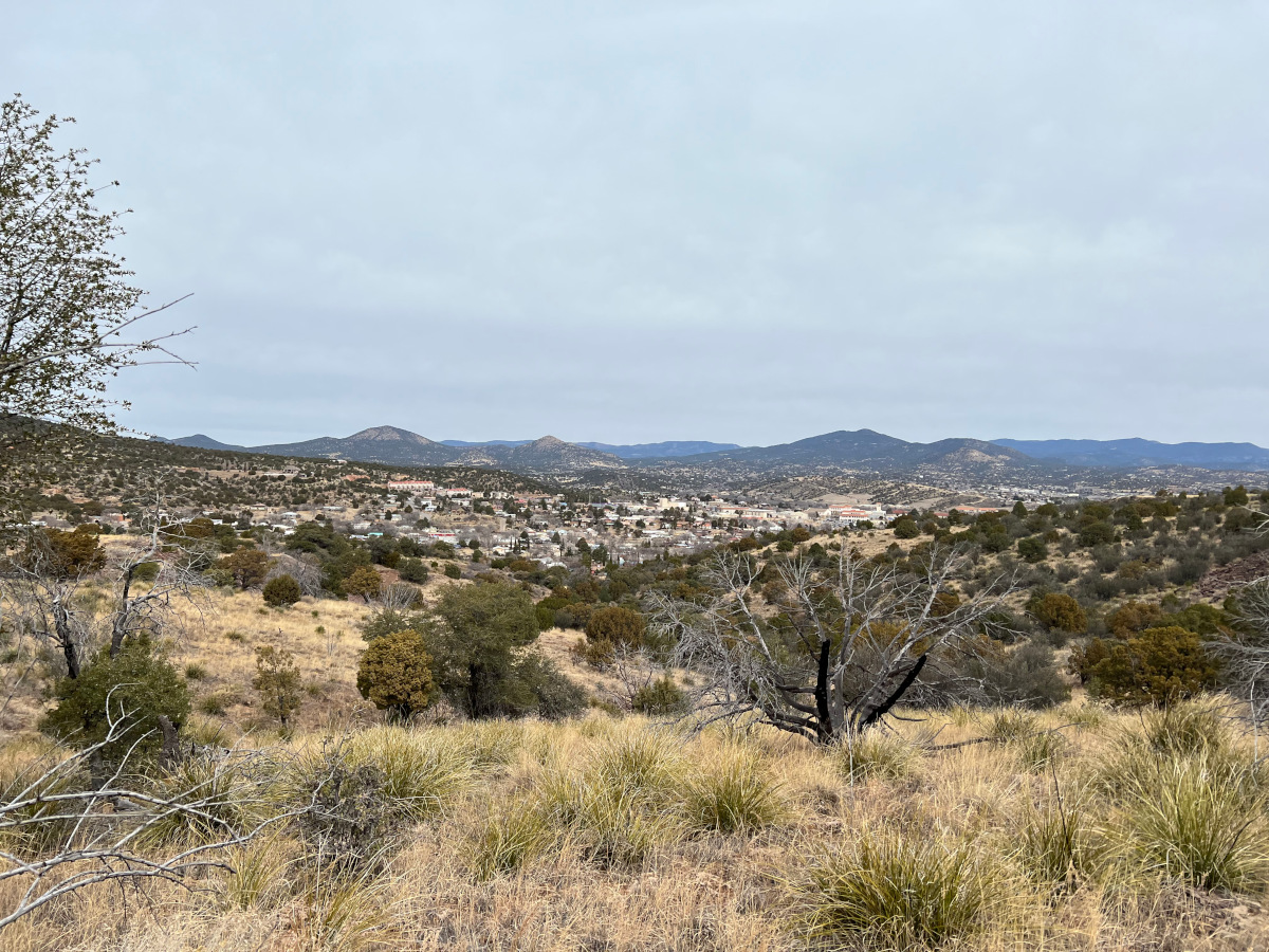
We arrived too early to check into our hotel, so we spent some time hiking the Boston Hill Open Space, which overlooks the town.  It was the last day of February, but temperatures were moderate, especially compared to back home.  

Like Bisbee, Silver City is a historic mining town, as evidenced by all of the holes in the ground at the Boston Hill Open Space.  A little after noon, we were able to get into our pet-friendly hotel room.


During the afternoon, we checked out the downtown streets, having a tasty beer at the Little Toad Creek Brewery.  Later, we walked Big Ditch Park.  This area used to be Main Street before the floods of 1895 and 1903.


Eventually, walking northwest from downtown, we found ourselves at the small Western New Mexico University.  Unlike New Mexico State University in Las Cruces, this university seemed well-integrated into its host city.


The hotel desk clerk recommended the Buckhorn Saloon and Opera House in Pinos Altos for dinner.  Opened in the 1860's and at 7000' elevation, we had a leisurely meal at the Buckhorn, sitting in front of the wood-burning fireplace and soaking in the atmosphere.


Silver City was a very interesting town, and we would like to come back for a longer visit someday soon.

Hatch: Eclectic

 From February, 2022.

One day, we took a drive from Las Cruces north to Hatch, New Mexico.

Hatch is a bit of a tourist trap. We walked up and down the main two streets with Callie.  The small town is the self-proclaimed chile capital of the world.


Then we went to Sparky's for a chili cheeseburger and chili fries.  I also had a chili chocolate malt.


Weirdest malt ever


Other sights that make a fellow go hmm.


Hatch falls into that category of places where I'm glad I visited but probably won't feel compelled to return anytime soon. 


Las Cruces: Picacho Peak Trail via Box Canyon Loop

 From February 2022

This was a hike in the Organ Mountains-Desert Peaks National Monument, which was about 20 minutes west of Las Cruces.

Exiting Hwy 70, we drove into a very exclusive subdivision.  Just beyond the fancy houses, there was a multi-purpose dirt road called  Picacho Mountain Loop. Soon after entering that heavily rutted road, we parked Julia's Subaru and walked the rest of the way to the trailhead. 

We hiked just over six miles, including the road walk in.  The views on top were amazing.  After reaching the bottom, we walked around part of the Box Canyon Loop and then back again.

From the bottom


From the top


Las Cruces, New Mexico: Retire Here? Intro

 From February 2022

Several years ago, Julia and I were researching places around the country where we might like to move after retirement.  I'm talking about internet research, using categories such as cost-of-living, colleges and universities, hiking trails, climate, political climate, taxes, etc.  Las Cruces checked off a number of the things that we liked--in theory.  However, there is no substitution for boots on the ground.

In 2019, I drove by myself through Las Cruces with the Scamp on the way home from a long trip out west.  Julia was not with me, electing to fly back from Las Vegas. She was still working.  Julia warned me not to visit Las Cruces without her, but I couldn't resist a drive-thru.  

Obviously, driving on Hwy 70 through Las Cruces and stopping for gas is not giving the city enough time for a fair evaluation.  However, my first impression was that Julia was not going to be visually impressed.  As in many other matters, she was not going to rely upon my first impression.  Las Cruces still checked off many important boxes.  Julia wanted to see it for herself.

When we spontaneously decided to take the trip out west in February, visiting the Las Cruces area and seeing what it had to offer was a high priority.  We knew that Las Cruces was brutally hot in the summer, so we figured that experiencing the city in February would be a perfect escape from our Wisconsin winter.  If we didn't like the city in February, we probably wouldn't like it in July.   We stayed ten days to give Las Cruces a fair chance.

The next few posts will go over what we liked and didn't like.


New Mexico: White Sands National Park


From February 2022

On one of our first days in Las Cruces, we drove out to White Sands National Park.   East of the city,  I noted the turn off for Aguirre Springs Campground where I stayed in 2018

As we approached the national park, we rose in elevation to the point that we were in the snow again.   There are a variety of "trails" at the national park.  We took the longest one at the end of the road, Alkali Flats, which was about 5 miles.


Basically, you walk through the sand using line of sight to the next visible marker.  The semi-frozen condition of the sand actually made it easier to walk uphill.  Where the sand thawed in the sun, it was one step forward, 1/2 step slide back.


In the middle of it all, Julia had to sit down and take in all of the wonder.


We hiked some some sand dunes a few years ago at a Jockey Ridge State Park in North Carolina, but White Sands was on an entirely different scale for size and beauty. 


New Mexico: Last Day in Albuquerque

On February 6th, we decided to walk along the river, starting with the Chris Chavez Trail which ran into the Rio Bravo Trail.  Then we continued on foot to Old Town.  The weather was warming up and the snow was pretty much gone by the end of the day.  We ate lunch at the Church Street Cafe. 


On the next day, we were on the road to Las Cruces.

Devil’s Lake

 We spent today climbing the East and West Bluff at Devil’s Lake State Park. Merrimac Free Ferry East Bluff