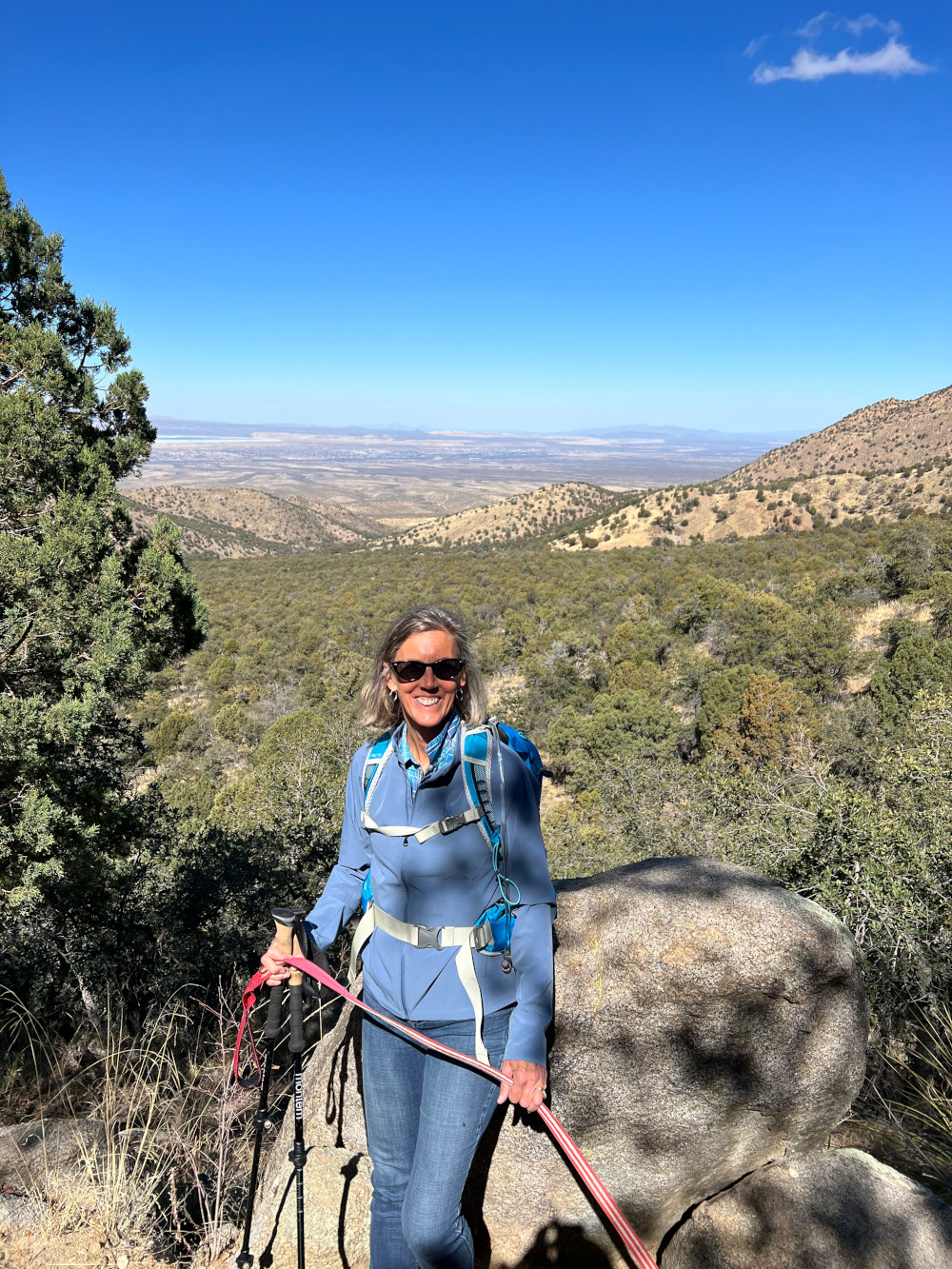
This trail was very close to our RV park in Silver City, so we hiked it several times. It's a 5.8 loop trail east of town. Very little elevation gain, but a great spot for Callie to burn off some energy. There were also petroglyphs to find.
Twin Sisters Creek and Dragonfly Loop
What's the Password?
I pulled up to the Dove Mountain Ritz Carlton guard shack in my dusty 2020 Dodge Ram. The guard came out wearing a frown and carrying a clipboard with a list of approved guests and hired help. He was pretty sure that I didn't belong. I rolled down the window and greeted him with a smile. "Wild Burro Trail," I said. He looked crestfallen and then motioned us through. "You two have a good day," he managed.
The Wild Burro Trailhead is technically on land owned by the Town of Marana Parks and Recreation Department. The only way to get there is through the property of the Ritz. We hiked Wild Burro once before, but yesterday we had a more ambitious hike in mind. Wild Burro is an easy 3 mile trail that mostly follows a flat wash. We chose the moderate Wild Burro Spur and Alamo Springs Loop, which is about a 6 mile hike, scrambling up and down the Tortolita Mountains.
We started out on the Wild Burro Trail but quickly joined Alamo Springs which gradually ascended to the tallest peaks in the area. It was a hot day, and we quickly were down to shorts and short-sleeves.
This is an area frequented by mountain lions, bobcats, javelina, and snakes. However, the only wildlife we saw that day were plants and birds.
The rocky trail consists mostly of 600 million years or older granite. Nothing like rock aging to make one feel inconsequential.
There was no password required to leave the Ritz property. We did not stop at the bar for a $13 IPA.
Hugh Norris Trail to Wasson Peak
This trail was recommended to us by a couple that we met while completing the Finger Rock Trail on Mount Lemmon. It was an excellent recommendation. This trail starts by climbing up well-maintained switchbacks and then along a ridge that climbs and climbs and climbs.
For the first hour, we were in the pleasant shade while still being able to see the sunrise off in the distance. As we climbed higher, conditions became quite windy. Also, we eventually began seeing wildflowers.
We kept seeing higher and higher peaks as we climbed. Usually the trail wound around the peaks, but we were left to wonder what might actually be the final peak. There were a lot of false summits. Eventually, we made it to the top. There were no higher peaks.
On the way down, I inadvertently got off on our trail toward a different trailhead. Julia was not a happy hiker. I tried to tell her that it was an opportunity to explore the Sendero Esperanza Trail (which we were accidentally on), but she was not amused. We had to backtrack (all uphill) and wound up hiking 11.3 miles with an elevation gain of 2818 feet. Her mood mostly recovered by the time we reached the car. A late lunch at our favorite Greek restaurant and a pint of IPA brought her mood back.
Maiden Pools via Ventana Trail
It's a drizzly, cool, and cloudy day in Tucson. Starting temperature was 46 degrees.
Julia and I got up at 5:30 a.m. this morning, had a quick coffee and were to the trailhead by 7 a.m. It was still pretty dark as we left the parking lot behind the Ventana Canyon Resort. The first mile took us past the rich people's estates. The trail was a narrow corridor with barb wire fence warning of the consequences of trespassing, but soon we began winding up through the canyon.
The trail passed back and forth across a dry wash. Huge saguaros rose up along both sides of the trail with closer prickly pair and pencil cactus leaning in to catch our clothing if we weren't careful.
After the first mile, we rose high enough to catch nice views of Tucson below.
Until today, there hasn't been much rain here lately, so the first"pools" were small and algae-covered. The Maiden Pools are actually an underground stream which rise to the surface in several locations on this trail. After the first mile or two, the trail climbed steeply via sharp switchbacks, and the terrain changed to tall grasses and shrubs, leaving most of the cacti below. The pool below was the largest of the ones that we saw.
By the time we reached this pool, the sprinkles had started. We hung out above the pools for a few minutes to eat our snacks.
Then the drizzle picked up, which had two effects for the rocky trail. The water brought out beautiful colors in the rocks, especially deep red, which Julia mistakenly took as blood or ketchup at first glance. Second, the bare rock became slippery as pig snot, which resulted in a very slow walk back to the trailhead in the rain.
No blood was spilled on the way down, and we made it to the truck. Total distance was 5.6 miles. Elevation gain of 1335 ft. And a leisurely 3 hours and 20 minutes for a hike that turned wet and cool. We rewarded ourselves with a late breakfast at Victoria's Cocina Mexicana on the way home. A little pricey but so good.
Waterfalls
Yesterday, we hiked with our friends, Dave and Ruth, to Hidden Creek Falls near Cornucopia, Wisconsin.
Dave and Ruth have obligations today getting ready for their son’s wedding on Saturday. Julia and I headed south to Copper Falls State Park.
This was a short “absolutely no dogs”trail. Callie was left behind in the pet picnic area. Temps were cool enough to leave her inside the truck, but she was mad. We made it up to her at “Dogs Allowed” Red Granite Falls.”
This was a delightful spot.
Peru Preparations
We are getting closer to the time for our Inca Trail hike and have started final preparations.
Getting there may be the most problematic. I've talked to lots of people whose travel plans via air this year have been cancelled or who have been stranded mid-trip--unable to get to their final destination in time for their excursion.
On this trip, we will be flying from Chicago to Dallas to Lima. Then boarding the next day on a Peruvian puddle jumper (or mountain hopper) to Cusco, where we will acclimate to the 11,152' elevation for a few days. Once the hike starts, there will be little to do but put one foot in front of the other for about four days. This will be Julia's first multi-day hike where she will be sleeping on the ground in a tent. I've been dreaming about my Appalachian trail thru-hike twenty-five years ago. I guess those are called flashbacks.
Peak elevation will be at Dead Woman's Pass (elevation 13,828'). Should be interesting. Will take a break from the blog until I get back.
![]() |
| Yellow soy bean fields--close to harvest |
Late Summer Update
The highlight of the last few weeks was winning the local pickleball tournament. Yeah, it's been a little slow in the travel and hiking department.
Not that we haven't traveled. Last week, we drove a couple of hours to the Appleton area to attend the funeral of Julia's stepfather, Bob. Both of her parents have passed, and there is just one stepmother left. Bob lived a very full life and to the age of 93, passing quietly in his own home surrounded by family. You can't ask much more than that.
We also had some Justin-related travel, which resulted in securing an apartment close to Justin's doctors and the hospital in Madison. With one step forward, we immediately took a step back when the state balked at Justin's agency's care giving plan. At this point, we are putting our faith in the agency's experience in getting similar plans eventually approved. Otherwise, we make be starting from scratch again in that department. We shall see.
Hiking has been limited to daily training hikes for the Inca Trail, which is coming up later this fall. We are getting the miles in, but we will not be able to replicate the altitude.
Reconnecting
During the last couple of weeks, Julia and I reconnected with college friends who we haven't seen in many years.
We missed the wedding of Brad and Fran's daughter when Julia and I were sick with covid. To make up for it, we decided to go for a hike at New Glarus Woods State Park.
Brad is more of a golfer than a hiker. I'm not sure we convinced him that hiking was very similar to golf, except no waiting, crowds, clubs, or balls. After hiking on a hot and buggy day, we found something that we all could enjoy at Bailey's Run Vineyard.
Later, we played games at Brad and Fran's house in Verona. It was there that their big dog, Harper, apparently decided that she did not like Callie's fragrance on my leg, so she bit me in the thigh--without breaking the skin. Brad's theory was that Harper didn't like men in hats. Okay, hats off for me.
It was the weirdest thing. I haven't been bit by a dog in fifty years. Julia calls me the Dog Whisperer. Harper didn't stay mad long, coming over under the dining room table and laying her head at my feet. Maybe it was the hat.
Brad and Fran were getting together the following weekend with another couple that we've known for decades and suggested that we all get together at Mike and Kathy's retirement home on a northern lake. We've had a standing invitation to visit them, so we got the okay to tag along. We would bring the Scamp to stay in. That trip will be the subject of the next post.Bisbee Side Trip: Chiricahua National Monument
From February 2022
This is another place that I've wanted to visit for a long time but never had. Chiricahua National Monument is about a 90 minute drive northeast from Bisbee. We started with the trails at the bottom near the entrance. Most people seemed to be crowded around the visitors' center; the crowd quickly thinned out on the trails.
Immigrants arrived here in the late 1870's establishing ranches in this dry, unforgiving landscape.
![]() |
| Faraway Ranch |
After hiking up to the Visitor's Center, where hordes of tourists milled about, we hiked back to the car and drove up to the top of the mountain. These views were what the tourists had come to see, and it was impressive.
Getting up to the top of the mountain during the 1800's would not have been a trivial thing. I wonder how many times the original settlers made it there.
Bisbee Side Trip: Madera Canyon
The drive to Madera Canyon was an exercise in how Google Maps can take you to unexpected places. Everything was fine until the advice to turn on to Hwy 62, a dirt road with frequent signs warning of drug dealers and human trafficking. The dirt road narrowed and then started climbing high up into the mountains. The drop-off was concerning, and then we met a jeep where it was not possible for two vehicles to pass. The other driver expertly backed up into an atv side trail so we could get by in Julia's Subaru.
Once we came down out of the mountains, all was good. Madera Canyon is a beautiful spot, and we arrived on a day when day fees were waived.
From the trailhead, we hiked along a small creek.
We then began climbing up Mount Wrightson. The trail got steeper and steeper. We were on the Bog Spring Trail when Julia started worrying getting back down with balky knees. Soon after, we hit snow and ice, making it easy to decide that was far enough.
It was still worth celebrating the partial trip up. We hiked 5.8 miles, ascending 1555 feet.
Devil’s Lake
We spent today climbing the East and West Bluff at Devil’s Lake State Park. Merrimac Free Ferry East Bluff
-
When I stopped in Albuquerque last week, Michael gave me four stouts. Two of the stouts were from Michigan and made by New Holland Brewing...
-
The weather is finally starting to cool off at night so that we can open the window screens and turn off the AC. With the modest change in...