Ice Age Trail: Peters Marsh


This is a continuation of the Antigo trip…

Day Three:  Per my custom, I was up early to eat breakfast and brew coffee.  The campground put out some nice advertising for Antigo’s farmer’s market, so I walked over to the Heinzen Peaceful Valley Pavilion, where vendors were still setting up at 7:45 a.m .  I continued to stroll around downtown and was one of the first customers at the 8 a.m. opening.  I scooped up two quarts of maple syrup to bring home and veggies to stir fry that night for dinner, along with some 50 cent sourdough rolls.


As I hiked back to the Brew Hut, someone yelled, “Hey, John.”  It was Deb from Lodi, who seemed as surprised to see me hiking down the street in Antigo as I was to see her driving down the street in Antigo.  Small world!

Back at camp, I changed into long pants, long sleeve shirt, and packed up bug spray and water.  Then I drove 20 miles northeast of Antigo to the Lumberjack segment of the Ice Age Trail.  The access was a small parking lot on Hwy A.

I wish that I could report that this was one of my favorite segments of the Ice Age Trail, but I can’t do that.  Nearly all of the ten mile hike (5 in and 5 out) was on old logging roads, which isn’t too surprising as this segment is called the Lumber Camp segment.  After I made it back home, I read the Ice Age Trail Organization’s notes on the section.

“Besides grassy stretches not mowed regularly, the heat, insects and special provision of water make summer less desirable for enjoying the pleasantries of a trail experience.”

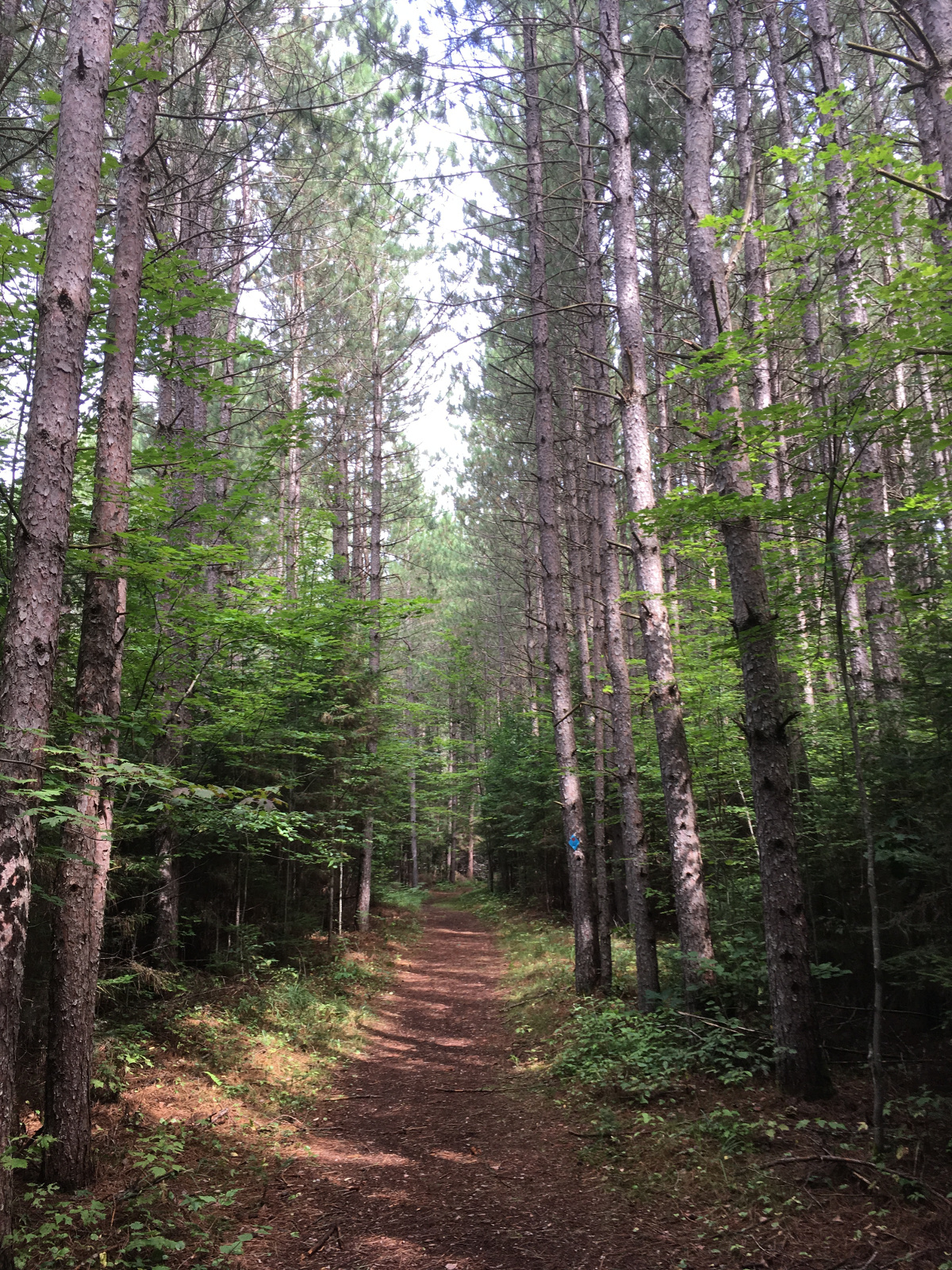
That pretty much summed up my hike.  The grass was chest and shoulder-high in places.  The trail wasn’t really wet so much as the grass was wet.  Within 20 minutes, my shoes, socks and pants (knee down) were soaked.  Here’s a sample of the trail.


In almost any hike, one can find natural beauty, and this segment was no exception.


And there were berries.  Not all the berries were ripe, but some of the berries were so ripe and sun-warmed that the berry would partly fall apart before exploding in sweetness inside my mouth
Of course, as I dawdled to pick the choicest berries, the mosquitoes ate me alive.  The fruit was worth it, but only to a point.  The Ice Age notes mentioned insects, not just mosquitoes, so they were probably thinking of the deer tick and wood tick that I plucked off when performing a “check” back at the campsite.  Neither were embedded yet, so that was a bonus.

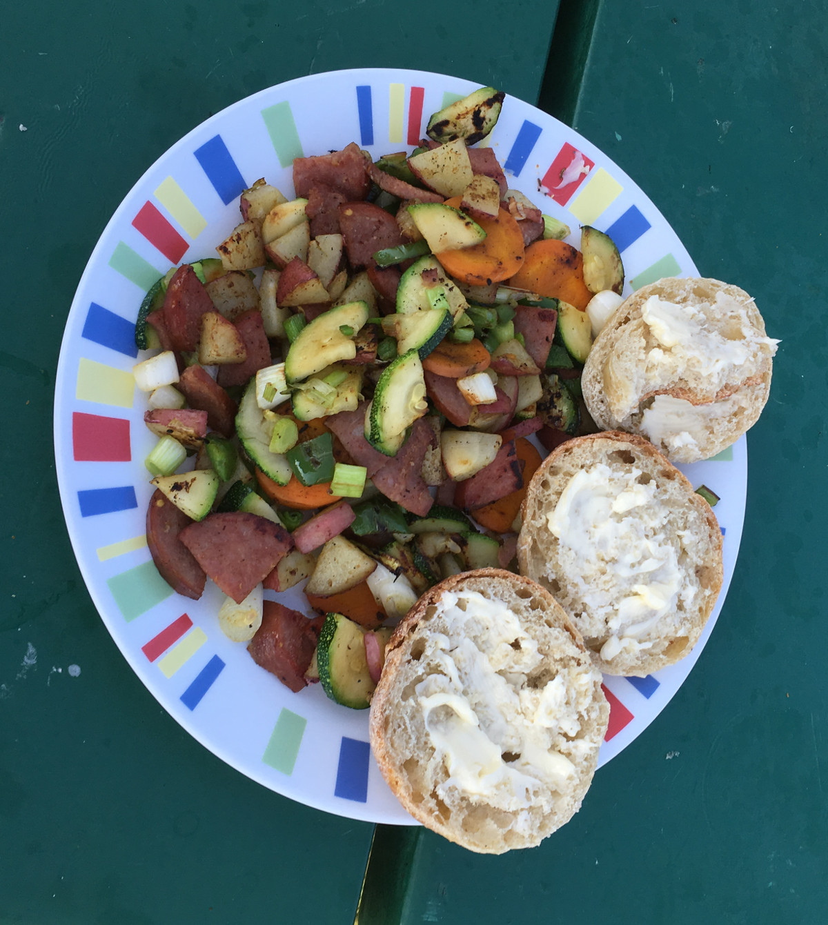
I ate an early supper:
Dessert was a Lakefront IPA and the Packer’s exhibition game against Washington. Life in the Brew Hut is good.


Antigo Lake Campground: Base Camp


Day One:  This is likely my last summer trip this year with the Brew Hut. School for Justin starts next week.   I have a family weekend pass and used it to tow up to Antigo Lake Campground, which is a very reasonably priced ($20/night) municipal campground northeast of Wausau, Wisconsin.  The campground offers full hookups, nice showers and toilet, free wi-fi, bike loaners, and campfire wood for donation.  Additionally, downtown and a grocery store are a short walking distance away.  The City’s hiking/biking trail of 2.3 miles runs right next to the campground.


There is an active industrial building across the street–Merit Gear.  There is some truck traffic during the day, but it was quiet at night.  I was set up by 7p.m on Thursday night, picked up some tortilla chips and a six pack of Lakefront Brewery’s IPA at the grocery store, and watched a little television before falling asleep by 10 pm.

Day Two:  Today, I woke up early, ate my granola, banana, and yogurt, brewed coffee and was hiking on the City trail by 7:30 a.m.  Unfortunately, I walked in the wrong direction (towards downtown), so I ended up walking about 3 miles.  This was a sign of things to come.  For a municipal trail, there were some nice views and a great boardwalk through area wetlands.


Back at the Brew Hut, the lazy part of me wanted to read a book and take the morning off.  However, that little voice in my head (maybe it was my wife, Julia), told me to hit the road and get some serious hiking in. Leaving the Brew Hut behind, I drove the Nissan Frontier northwest, entering the Chequamegon-Nicolet National Forest.  One of my goals was to scout out future dispersed camping spots for the Brew Hut on future trips.  That didn’t work out so well.  I’m sure there are spots (although I haven’t found mention on-line), but I didn’t find anything suitable.  Eventually, I drove by the a sign for the Jones Springs Trail.  Several loops were available, although there was a warning about high standing water and flooded streams for a small sector of the trail.


Being a former Appalachian Trail thru-hiker, I sometimes ignore warnings, such as this one, thinking that I don’t mind getting a little wet or that the warning was intended for casual hikers, not me.  The red loop was about 6.4 miles, per the map.  80% of the trail was beautiful, mostly following up and down ridges.  Sometimes, the hills were challenging.  There were a few beautiful backcountry campsites for tenters.


With just a couple of miles left in the loop, I came across this:

The police tape did give me pause, but I noticed that there were no signs actually closing the trail.  It was only a short distance to finish the loop.  I felt confident that I could pick my way across any water hazards.  The first mile was easy and dry.  After that, I noticed a lot of dead trees across the trail–as though no one had maintained it for some time.  Then the trail dipped just a little in elevation, not much, but enough to notice some water ahead.  I started across logs that someone had evidently put across the beginning stretch.  After that, the logs ended, and there was absolutely nowhere to go. The water beyond was more than a foot deep, and there was deep mud under the water.

I started back across the log to firm ground, so I could re-evaluate the situation.  Boom–I fell to the right, my right leg going into the mud about calf high before I pulled it up again.  Okay, going across wasn’t going to work.  I looked to the right and left to see if there was a way around.  Nope, water and mud as far as I could see.  So I walked back to my little police tape scene and continued on to see if the orange loop was open.  Nope, more police tape.  I went back to my map, and it appeared that the “small” part of high water blocked my way to completing any kind of loop.  At this point, I might have said “Fiddlesticks” or some similar expletive.  I was stuck and was going to have to do a complete reversal of my path.  At least I knew it was a pretty hike and higher ground. All the same, it turned into a 12 mile in and out, instead of a 6.4 mile loop.  That gave me 15 miles for the day.

I felt like I deserved a good meal.  T-bone with fried plantains on the cast iron skillet. Along with a glass of homemade chardonnay, I had enough motivation to blog tonight.

Kohler-Andrae State Park: Days Two and Three


Day Two: We woke up early, brewed coffee, ate breakfast, and were on the trail before the dew dried.  Specifically, we hiked from our campsite to the Sanderling Nature Center.

Intricate, amazing spider webs were everywhere along the trail, glistening in the early sun and dew. We also saw multiple adult deer and fawns.  There’s just something about hiking early in the morning with no one around that brings peace and joy to my soul.


Later in the morning, Julia did some wading, while I found a picnic table under a shady tree.   You’ll notice my new hat, picked up at 3 Sheeps Brewing in Sheboygan.


3 Sheeps has a cavernous warehouse tasting room with picnic table spread out over the concrete floor and overhead doors opened up for air circulation.  I tasted several sours, which pushed my limits (not a bad thing).  The bartender was informative, and the tasting room was unique.

Later that day, we enjoyed Mexican food on the second floor deck at El Camino Mexican Restaurant in Sheboygan.

We started a campfire early that evening, but were eventually chased in by rain showers.

Day Three:  Our plans for this day were to pack, hitch up, and tow the Brew Hut to a county park along Lake Winnebago.  However, as we drove within a mile of Calumet County Campground, the cell phone rang.  I could only hear Julia’s side of the conversation:  “What, he did what, what, how bad is it?  what?”

The short story is that our son Justin injured his ribs during a transfer at the disability leadership conference.  He needed medical attention that day, which required us to tow back home and take Justin to urgent care in Madison. 

Everything checked out (bruised ribs requiring rest), but it was a good reminder that plans are to be made in Jello, not concrete.

Kohler-Andrae State Park: A Short Trip to Wisconsin’s East Coast


Earlier this summer, my son was scheduled to take part in a Disability Leadership retreat at a local college for a five-day stay.   Someone new to his personal care was going to help Justin during the week, so we were hesitant to leave on our own adventure until a successful overnight had passed.  I spent Sunday afternoon getting the Brew Hut ready for travel for what we hoped would be our first extended trip. 

Day One:  After not hearing from Justin and assuming that all was well, we hitched up the Brew Hut and were on the road by 8 a.m.  We drove by way of Columbus, Fond du Lac and Sheboygan, arriving at Kohler-Andrae State Park at 11 a.m.  We didn’t have reservations. Our backup plan was to try other Lake Michigan shoreline campgrounds within an hour or so.  Because it was Monday morning and most of the weekend campers had left, we had no problem securing a site with electric hookups.

I last visited the beach at Kohler-Andrae about thirty years ago.  At that time, I remembered the beach being wider and the dunes being barer, but my recollection may be flawed or perhaps influenced by beer.  I think my last visit was during college and after dark.  I probably didn’t do much hiking, but that’s what we do now.


The third photo is the way that I remember the dunes, but a helpful, informative sign explains that human and animal activity causes erosion that leaves the sandy scar.  When I was a kid, we loved to run and jump off the dunes without giving much thought to the consequences of our fun.   On this trip, I did not try to relive my youth, break an ankle or scar the dunes.

Informational signs warned against straying off the boardwalk trail but also provided knowledge:


That evening, we drove into Sheboygan and had a fantastic meal at Harry’s Prohibition Bistro on South Pier Street.

The appetizer special was mussels pan seared and finished in a reduced red wine sauce with lots of garlic.  Often, ordering seafood in Wisconsin is a mistake.  Not this time.  The chef stopped by to see if we were enjoying the dish, saying that he was going to make some up for himself before leaving for the evening.  The main dish, pizza, was very good but we probably could have stopped after the mussels.


After dinner, we meandered up and down the Sheboygan pier.  It was a gorgeous night.


Grand Marais, Part 3


After our long hike to Chapel Falls/Beach and Mosquito Beach/Falls, we drove to Munising, parked near the harbor, and toured downtown Munising on foot.  Similar to many other Upper Peninsula towns, it seemed to be struggling.  We saw many empty commercial buildings, many recently closed. 

We ordered beers (UPA’s) at the Barge Inn and hung out in their beer garden for the latter part of the afternoon.  No food was served in the bar, so they directed us to a stand behind the bar that sold food.  I had a burger.  Julia had a taco assortment, and we topped it off with onion rings.  Our appetites were on overdrive so we walked over to Dairy Queen and had some ice cream later.

Around 8 pm., we boarded the boat for a two-hour cruise.  The views were amazing.

Unfortunately, there was no sunset to see on this cruise.  First, the sun disappeared behind a cloud bank. Then Grand Island blocked whatever sunset would have happened if there hadn’t been clouds.  Nevertheless, we loved the cruise and felt it was very worthwhile.  While we saw some of the same scenery while hiking, it provided a totally different perspective.

At this point, it was getting dark, and it was time to head home.  The drive should have taken about an hour.  Shortly after leaving Munising, we began to see deer cross in front of the car that was ahead of us.  We slowed down accordingly and our eyes peeled for deer ahead so that we didn’t hit any deer.
Unfortunately, thirty minutes after leaving Munising, a deer hit us.  I saw it out of my peripheral vision on the driver’s side of the road.  The deer must have figured that it was safe to cross after our headlights passed.  I thought we had safely passed it by also. 

But we didn’t.  A horrible clunk sounded toward the rear of the Toyota Sienna.  With my breath held, I pulled over and hoped that it had bounced off without causing any damage.  Wrong.

The deer hit the plastic bumper cover just past the rear tire well on the driver’s side, partially ripping off the plastic tabs attaching that piece to the vehicle and to the rear bumper.  It also bent a custom metal plate next to the rear wheelchair ramp, making it difficult but not impossible to lower the ramp when I checked to see if the ramp had been damaged.  When I tried to raise the ramp back up, I realized that the bent metal plate was now preventing me from doing so.  So I grabbed Justin’s metal tie down and used it as a hammer to unbend the plate so that we could get the ramp back in.

The bumper cover itself was flopping to the side of the vehicle, making it impossible to drive without doing something to prevent the wind from catching it and causing the whole thing to flop across the center line.  We ended up using an assortment of bungee cords to hold it temporarily in place, attaching one end inside the hatchback and the other end on an undamaged plastic piece under the tire well.  We could only drive about 30 to 35 mph without having the bumper cover flopping badly in the wind.  We limped home this way and turned an hour trip into a more than two-hour drive.

In the morning, I made a trip to the hardware store, purchasing tools and gorilla tape that enabled me to remove the damaged piece altogether, and to tape closed some delicate pieces normally covered up by the bumper cover.  We made it back to south central Wisconsin without incident.  It wasn’t the way we wanted to finish the vacation, but it could have been much worse if we had hit the deer head-on.

Parts have been ordered, and the Toyota Sienna is scheduled for a body shop repair next week.

Grand Marais, Part 2


Day Three:  We had big plans for day three, but rain and muddy road/trail conditions made us reassess.   The main road through Pictured Rocks is paved (H58), but some of the roads to trailheads are not.  The Visitors Center warned us not to try the unpaved road to Little Beaver Lake trailhead.  It was not in great condition, and she did not recommend it for our low clearance wheelchair van.   She thought we could make the Chapel Falls trailhead if it wasn’t actively raining.  As we started out, drizzle and fog greeted us.


We decided to drive the length of H58 and check out some of the roadside scenery, along with the City of Munising, Michigan.  There were many waterfalls:


In Munising we stopped at a craft beer bar that called itself a brewpub. Lunch was pasties, an Upper Peninsula local food once served to miners.  It’s a semi-circle pastry filled with meat and vegetables.  I washed mine down with an “I’d Cry Over Spilt Milk Stout”, brewed by Pictured Rocks Brewing Company.  Julia had an Northeast-inspired IPA called “The Fallen” by the same brewer.  The beers were worthy.

That afternoon, the weather still wasn’t cooperating, so we headed back to Grand Marais and spent the afternoon reading our books.  We made a repeat visit to the Grand Marais Tavern for dinner and turned in early.  The weather forecast was for better weather on the next day.

Day Four:  This turned out to be a huge day in some good ways and bad ways.
We got up early, ate breakfast and drove to the Chapel Falls Trailhead.  The five mile unpaved road was wet and rutted.  Potholes were many. I wished for my Nissan pickup with 4 wheel drive, but the Sienna made it slowly through.
The trail started off dry, and Chapel Falls was beautiful.  The trail soon became more difficult.


The closer we hiked to Lake Superior, the wetter the trail became.  It seemed like we were hiking in a creek at times.    Eventually, we prevailed and came out at Chapel Beach.  Here, there is an amazing tree that was still growing after the arch supporting its root structure fell away.  Notice the roots stretching from left to right to the soil on the other side of the fallen arch, still nourishing the tree.
Between Chapel Beach and Mosquito Beach, we hiked high above the shoreline on bluffs eroding into the lake.  Mosquito Beach was more rock than beach, and there were few mosquitoes (a pleasant surprise).


The day became warmer as we hiked from Mosquito Beach to Mosquito Falls, and the mosquitoes did begin to arrive.  A short hike up to the parking lot, and our ten-mile circle route was completed. 
The day was not over.  For the evening, we scheduled a sunset boat ride on Pictured Rocks Cruises.  That post, which includes an unexpected adventure home, will be detailed in Part 3.

Camping with Elon?

 This interesting rig was in our campground last night. The trailer appears to be a prototype from a California start-up company.